Long Canada update: Edmonton to Hay River
We're in Hay River, NWT, where the bugs are thick as anything. We've apparently picked a very bad year for bugs, on account of how wet it's been. Tonight we're in a hotel, again. We'll pimp our ride to offer a bit more bug protection, and head to Wood Buffalo National Park tomorrow. But I'm skipping ahead. Long entry follows.
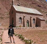
Our second day in Edmonton we went with Gwen to historic Fort Edmonton. It’s not the original fort, but a reconstruction, and it’s not even in the original location; but over time the city has moved a variety of historic buildings there, and grouped them by era, so that now there is an amazing amount of Edmonton history at one large park. In addition to the reconstructed fur trade fort, there are “streets” devoted to the years 1885, 1905 and 1920, complete with living history demonstrations and shops stocked with an impressive number of period items. Plus, we had ice cream.
We left in the afternoon for the town of Athabasca instead of staying another night in the city; it was a fine hotel, but expensive, and we were ready for the wide open air and our little metal box again. Athabasca, formerly Athabasca Landing, is about 90 miles north of Edmonton at the southern-most point in a southern dip in the Athabasca river. By the 1880s it had become a major jumping-off point for river transit to the Mackenzie and Peace River districts. The old ox cart trail from Edmonton can still be seen in some places, just as wagon ruts from the Oregon trail can still be seen in spots across the US west.
The drive up was wide open and flat. At Athabasca, we walked the historic riverfront and ran a few errands. I know that my great-great grandparents and my great-grandmother stood at this spot many times, waiting to board a steamship north.
We found the two campgrounds full. Undaunted, we drove 20k up the road to a county park – only to find the campground there dreary, and more importantly, lacking any source of portable water. So in the end, we wound up at a hotel after all, in a smoking room since that’s where many hotels allow dogs.
We hit the road early the next day and drove to the town of Peace River. This longer route took us along the southern shore of the Lesser Slave Lake (again – nothing to do with Slaves but with the Slavey people). We stopped for a hike and a visit to the Boreal Center for Bird Conservation. Huge, huge numbers of migratory birds spend the summers in the boreal forests of Canada. For some species, 90 percent of all of the birds are in this part of the planet for the summer. The entire coast of Lesser Slave wake is throbbing with the sight and sound of birds.
This area was still surprisingly full of people; it’s a big recreational area. Nonetheless we began increasingly to have a sense of being up here. Way north, and we’re nowhere near as north as we aim to go. Amazingly, after leaving the Slave Lake area the landscape turned once again to farms. We’re at, like, the latitude of Finland. Who are these people, farming up here? For miles and miles, there are yellow fields of canola as far as the eye can see. Along with the occasional oil derrick.
We got early to the town of Peace River, chastened by our experience in Athabasca and determined to get a camp site. The campground, run by the local Lions Club, is one of those quirky private campgrounds with lots of character. It was busy, but we had a nice spot at the edge with a view of the woods and the river. Many people at the campgrounds and hotels seem to be work crews, driving imposing, mud-splattered trucks and SUVs with mysterious mechanical equipment in back.
The Peace River is another giant of the Canadian river system, running from the Rockies eastward. The descent into the town of Peace River is a stunning surprise, dropping down from those endless yellow canola fields in a wide and lush series of hills to the wide river below. It was hot – really hot – so we had a lazy afternoon, walking the riverfront trail a bit and stocking up on provisions.
At night the hot weather turned into a crashing thunder storm, lights flashing and rain hammering on our little metal box. Morning found us socked in by fog, which dissipated as soon as we climbed out of the river valley. Then we did this for 300 miles:
Rolling landscape with no real landmarks, and mixed forest of coniferous trees and aspen and poplar, with increasing marshland. Gradually the farms became less frequent - small farms carved out of the forest rather than clumps of forest carved out of the farms. Enrico said that it reminded him of Maine. (Except, he said dryly, that you could drop the whole state of Maine up here, and never find it again.) Along the way were French Metis communities with charming names, and first nation lands with a familiar air of economic hardship.
Then, there were no more farms, and at last we crossed the 60th parallel! We visited beautiful Louise Falls, where we tried to camp, but long story short we ended up in the town of Hay River, setting foot at last on the enormous Great Slave Lake.

It's hard to describe this place. The closest we've seen are the remote towns of Alaska, lots of untamed nature mixed with rusting junk just left where it is. And swarms of enormous black flies. The person at the visitor's center told us to buy extra wiper fluid, because the flies are so thick at Fort Providence that we'll likely use up all our fluid just wiping them off the windshield. I am not making that up.
It's good to see all these places. We're hoping for dry weather tomorrow as we head out to Wood Buffalo Park.
No comments:
Post a Comment